
Along the Legendary Sêrêpok River
"This islet is where the elephant king Y Thu Knul used to set up a village, set up a village to live with the indigenous people along the Serrêpôk river since ancient times..." – Uncle A Ma Vông said as he held the hoe to me, as I opened the tent to prepare for the camping night in this place. I stopped to focus on hearing more of the story of the peaceful Buon Don land by this legendary Sêrêpôk River.
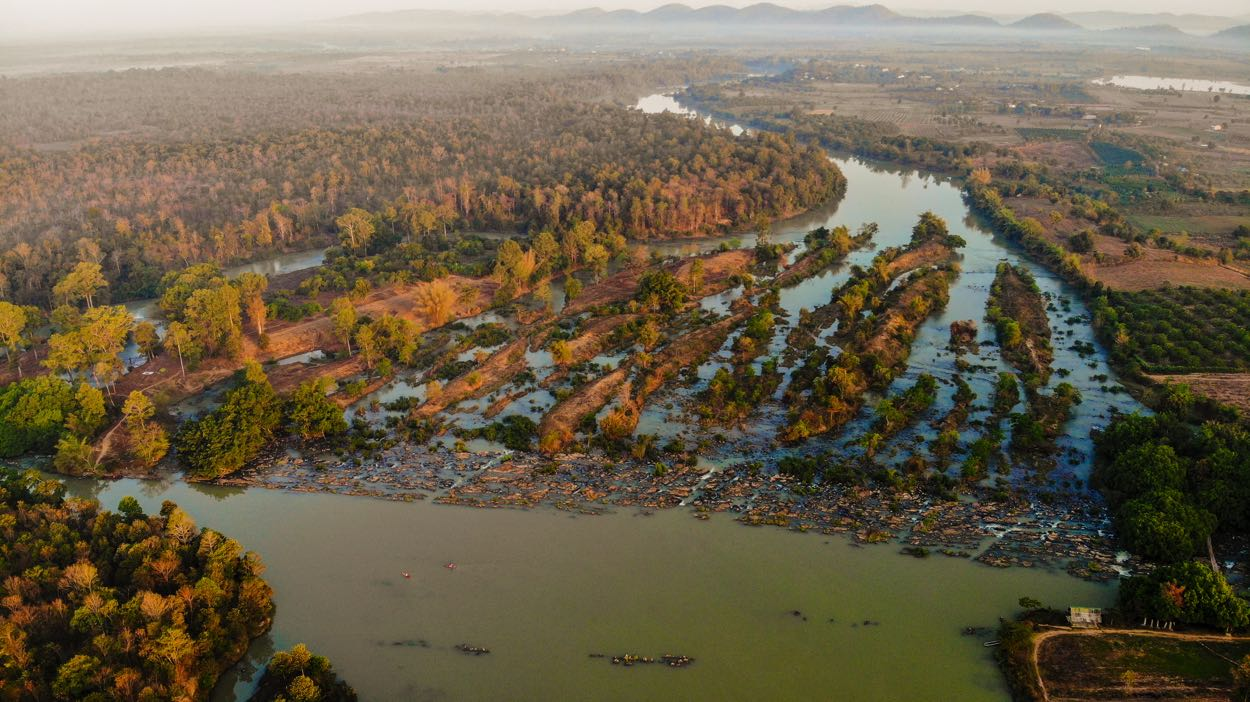 When the elephant king Y Thu Knul was searching for new land for the villagers in the past, he came across high mudflats close to the hand-shaped rapids along the Serra river as it meandered through the Yok Don mountains, where the river split into seven streams and encountered tremendous rapids. He thought it was conceivable to grow, hunt, and gather because the area was shielded by old bushes. He settled the locals here.
Thanks to the ease with which the Sêrêpôk River flowed, the region quickly developed into a significant commerce hub for the three Indochinese nations of Laos, Vietnam, and Cambodia. Many Lao people stayed with the local M'Nong and De people to establish a settlement by the riverside after coming across this lovely highland during trade trips up the river. The Ede people name it Keng Apa, the M'Nong people call it Bun Rkau, the Kinh people call it Buon Don, or Ban Don, and the Lao people refer to this location as "Bang Don," which means "Island Village."
The Elephant King Island, also known as the island where I was standing with my uncle A Ma Vông, is situated on a branch of the Seven Branches Waterfall. It's very silent here. The flatness of the river's surface caused the ancient forest trees to reflect the sun's earliest rays. With the early mist drifting across the water, the area becomes more enchanted. While lightly gliding along on my SUP, I flicked my paddle and noticed an elephant crossing the narrow creek from the bush to the village. After a protracted campaign to increase public awareness about wildlife protection, traders no longer train their elephants to carry passengers but instead teach them how to interact amicably with tourists.
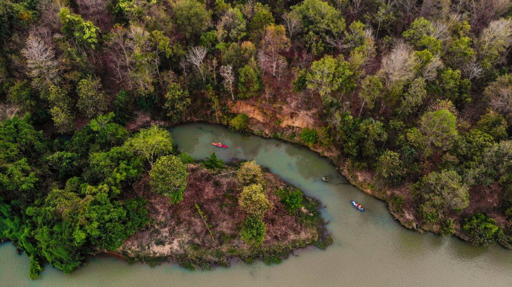 Uncle A ma Vông added, "This Sêrêpok line is extremely remarkable, it merely flows backward but also divides into two lines, inside the chisel," as the SUP board touched down on The Elephant King Island. I've heard this a lot, but now I get the chance to discover its amazingness. The Sêrêpôk River flows back upstream to Cambodia before joining the Mekong, then down to the Southwest of Vietnam before joining the large sea, in contrast to many other rivers that all run into the ocean.
The Krong No and Krong Ana rivers, one often opaque and the other transparent, meet at the confluence to form the Sêrêpôk stream. At the river's confluence, the two streams converge and merge with the roiling Chồng river. The Krong Ana River is known as Vợ River (or Cai River) by the locals, who also refer to the Krong No River (or Chồng River) as a representation of husband-and-wife loyalty.
The idea that there was just one Caesar River in the past has also been disseminated. A kid from the Kuôp merchant at the time fell in love with a woman on the other side of the river. Their bond grew closer. They want to prevent and separate their love because the two families of this pair are already at odds with one another. The couple committed suicide by jumping into the river together on a cool moonlit night. Dark clouds appeared quickly as they passed away, splitting the river in half while it was heaving with water.
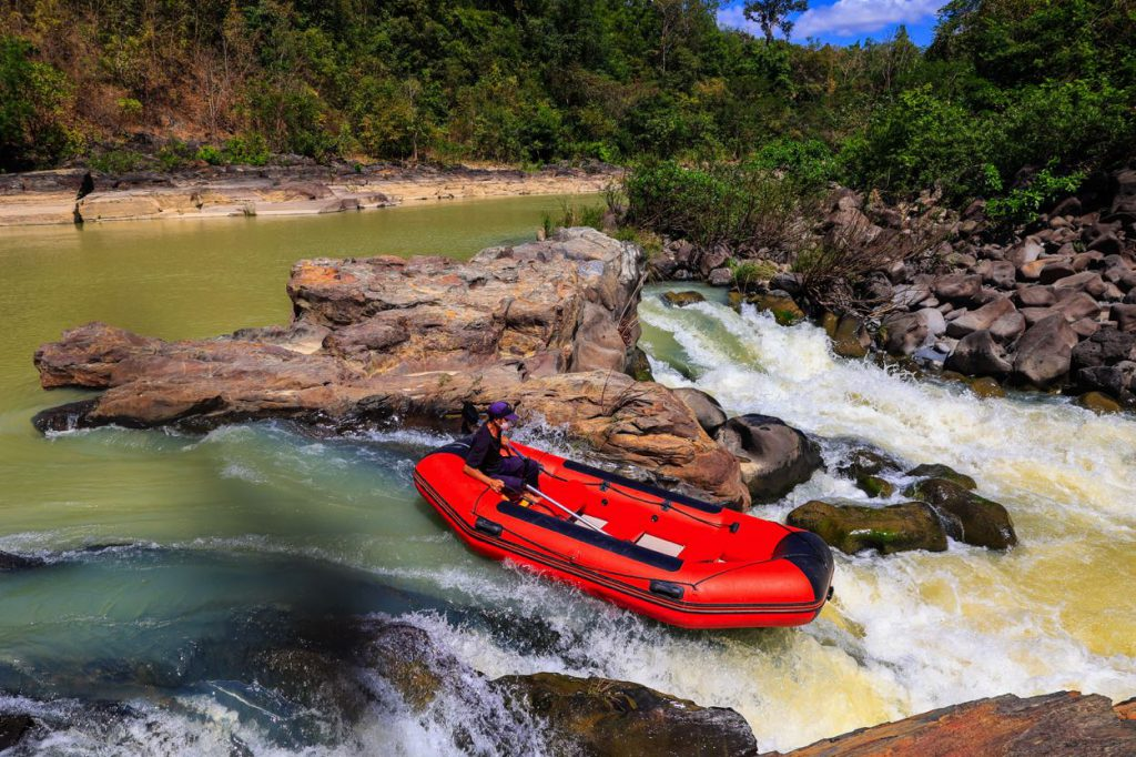 The tales surrounding the Sêrêpôk stream did not shock me enough when I was taken to the river's first waterfall, Gia Long (also known as Dray Sap Thuong waterfall), which King Bao Dai gave the name. A young Ede was waiting beside a pontoon boat to take me on my exploratory tour along the Sêrêpôk River, so I followed the small suspension bridge down to the natural jade-green lake below Gia Long Waterfall.
I took in the breathtaking natural splendor as the boat slowly drifted. The blue river surface reflects the floating white clouds, the blue Central Highlands sky, and the green of the forest on both banks of the river. I occasionally get giddy on the little rapids boat. When the people are fishing or doing the laundry, the river can be incredibly serene in certain areas.
The pontoon boat that transported me to the Dray Nur falls could clearly hear the roaring sound in the distance. In order to see the Central Highlands' most magnificent waterfall, I moved more quickly. Gradually, a massive wall of water with fantastic water smoke floating in the air appeared.
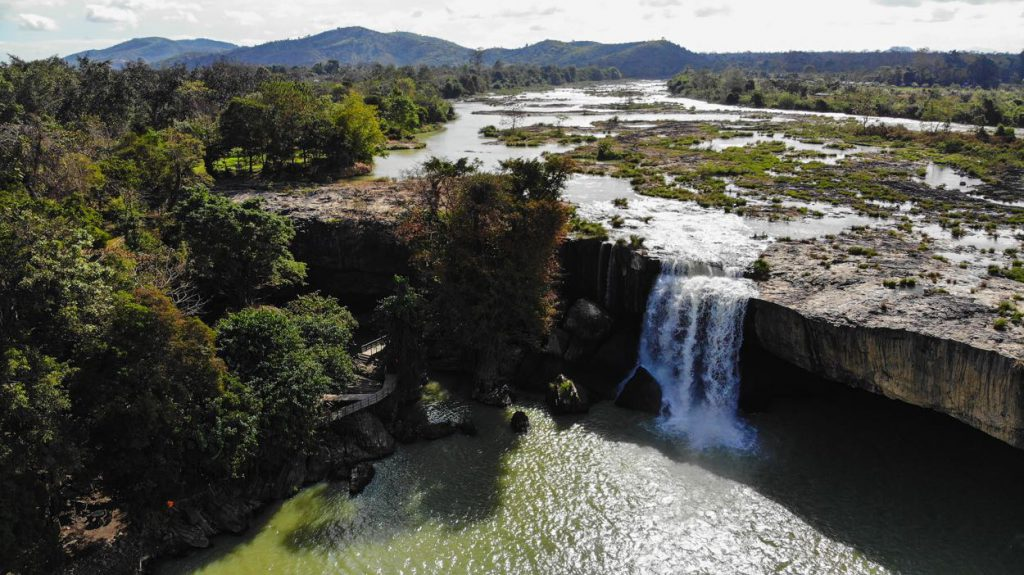 It was time for the afternoon sky to fall, and I was completely engrossed in that glorious view until the call of the boatman jolted me back to the present. I bid Dray Nur Falls farewell and set out on my own adventure, the river flowing backward in the same direction.
Source: Vinh Gấu